
Local News
KWSO FIRE UPDATE 9/25/20
Sep
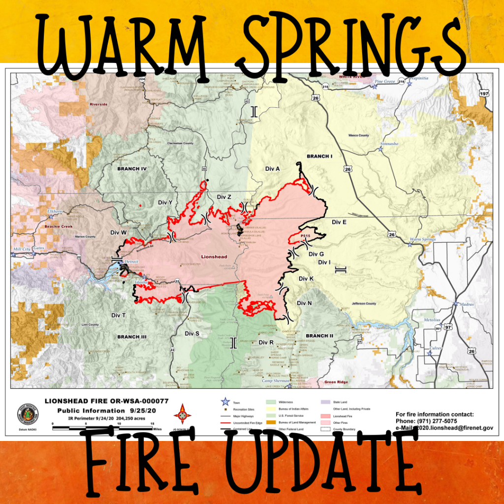
The cold front that moved through the area yesterday brought rain to most of the fire. This slowed fire activity, but the east side of the fire dried out quickly with gusty southwest winds. Fuel moistures on the east side of the fire were still dropping Thursday afternoon. The wind and drying fuels resulted in some increased burning in green islands well within the fire’s perimeter. These islands may put up smoke during expected windy conditions today. Another cold front will bring more damp weather to the fire area today.
The combination of damp weather over most of the Lionshead fire and the continued hard work of the firefighters resulted in containment increasing to 28%.
Very little movement has occurred on the north edge of the fire on the Warm Springs Reservation over the past few days. The contingency line north of the fire’s active edge is secure. Plans are to go direct on the fire’s edge when it is safe and productive to do so.
An increased containment on the burnout finger near Badger Creek now surrounds the finger and will provide further protection should fine fuels dry out significantly during today’s predicted winds. Smoke will continue to be visible as interior pockets of fuel dry out and burn. These interior pockets do not pose a risk to the containment line in the Sidwalter Butte area.
Other areas around the perimeter of the fire are being patrolled and mopped up. Some chipping operations are ongoing.
Today at 9 a.m. evacuation level changes went into effect in Marion County. The changes are being made following careful consultation between fire management officials and the Oregon Department of Transportation, Marion County Public Works, law enforcement, and many other partner agencies.
Coordination with Beachie and Riverside fire operations over future plans for the north northwest area of the Lionshead Fire continues.
Roads and trails near the fire remain closed for public safety. The 12 Road and the 46 Road will remain closed to the public for the near future. This includes roads and trails on the Confederated Tribes of Warm Spring lands adjacent to the fire and a 40-mile section of the Pacific Crest Trail between Santiam Pass and Olallie Lake. The Willamette National Forest, Bureau of Land Management, and State lands around the fire remain closed to the public. Go to InciWeb.gov for more information about closures in the area.
You can read the full morning report HERE
View a PDF copy of today’s fire map HERE